
301
OpenStreetMap community
4429 readers
2 users here now
Everything #OpenStreetMap related is welcome: software releases, showing of your work, questions about how to tag something, as long as it has to do with OpenStreetMap or OpenStreetMap-related software.
OpenStreetMap is a map of the world, created by people like you and free to use under an open license.
Join OpenStreetMap and start mapping: https://www.openstreetmap.org/.
There are many communication channels about OSM, many organized around a certain country or region. Discover them on https://openstreetmap.community/
https://mapcomplete.org/ is an easy-to-use website to view, edit and add points (such as shops, restaurants and others)
https://learnosm.org/en/ has a lot of information for beginners too.
founded 5 years ago
MODERATORS
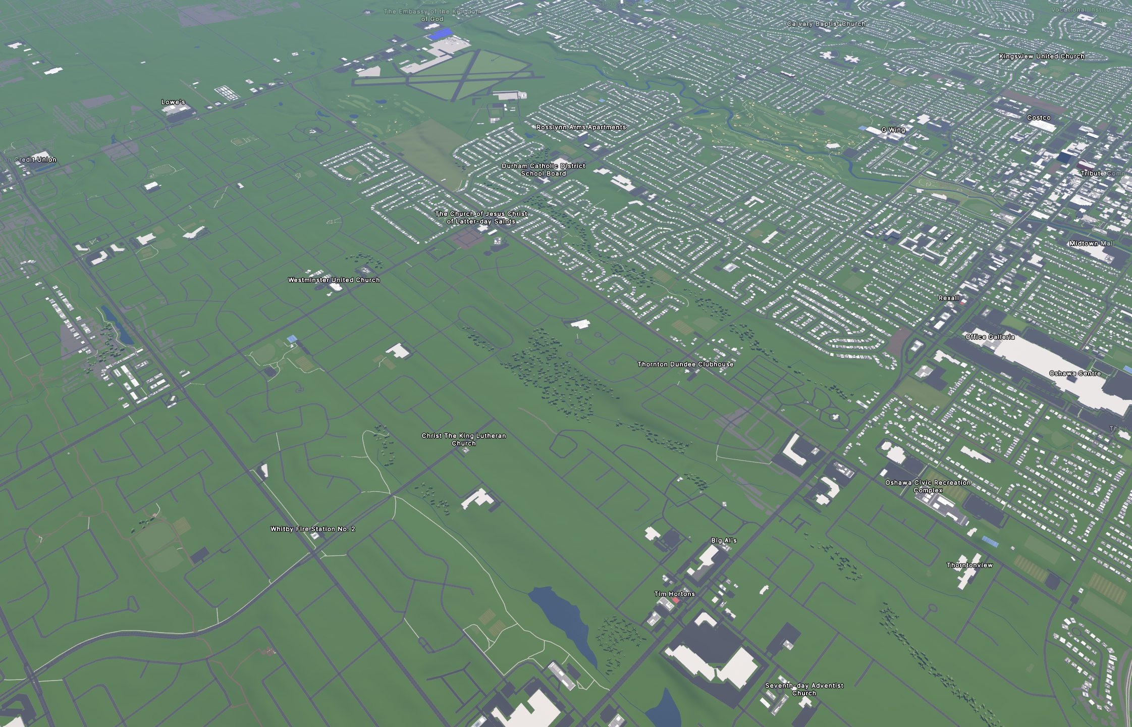
302
37
I used https://streets.gl for the "Google Earth" view of the OSM data.
Much of the work was done with the help of https://rapideditor.org/, although there was also a LOT of manual tracing and corrections along the way.
We have so much new development in the area that I had to rely on some pretty updated satellite images and local surveying to get most of that done (with more to be done in the future as several hundred more homes go up this year).
I used a combination of Bing, ESRI world imagery (the regular, not "clarity" beta), and Maxxar Premium imagery.
Totally worth it!
303
304
305
306
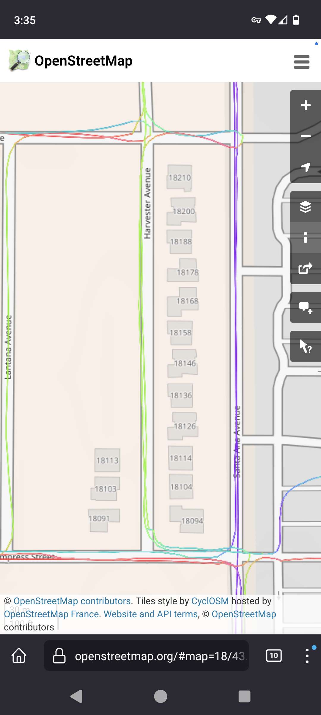
26
I'm doing my part by adding missing buildings in my city starting by the schools. I've even convinced a friend to join me.
(imagizer.imageshack.com)
307

309
310
311
312
313
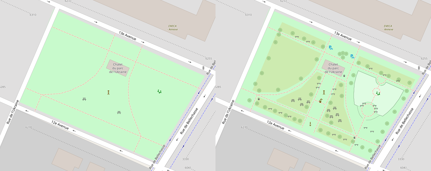
314
When I get bored of adding in buildings (much of my city doesn't have buildings yet.) then I like to do a little "micro-mapping" of local parks. I got the idea from Reddit and immediately fell in love. It makes me so happy to see them on the map when I'm navigating later!
315
316
317
318
319
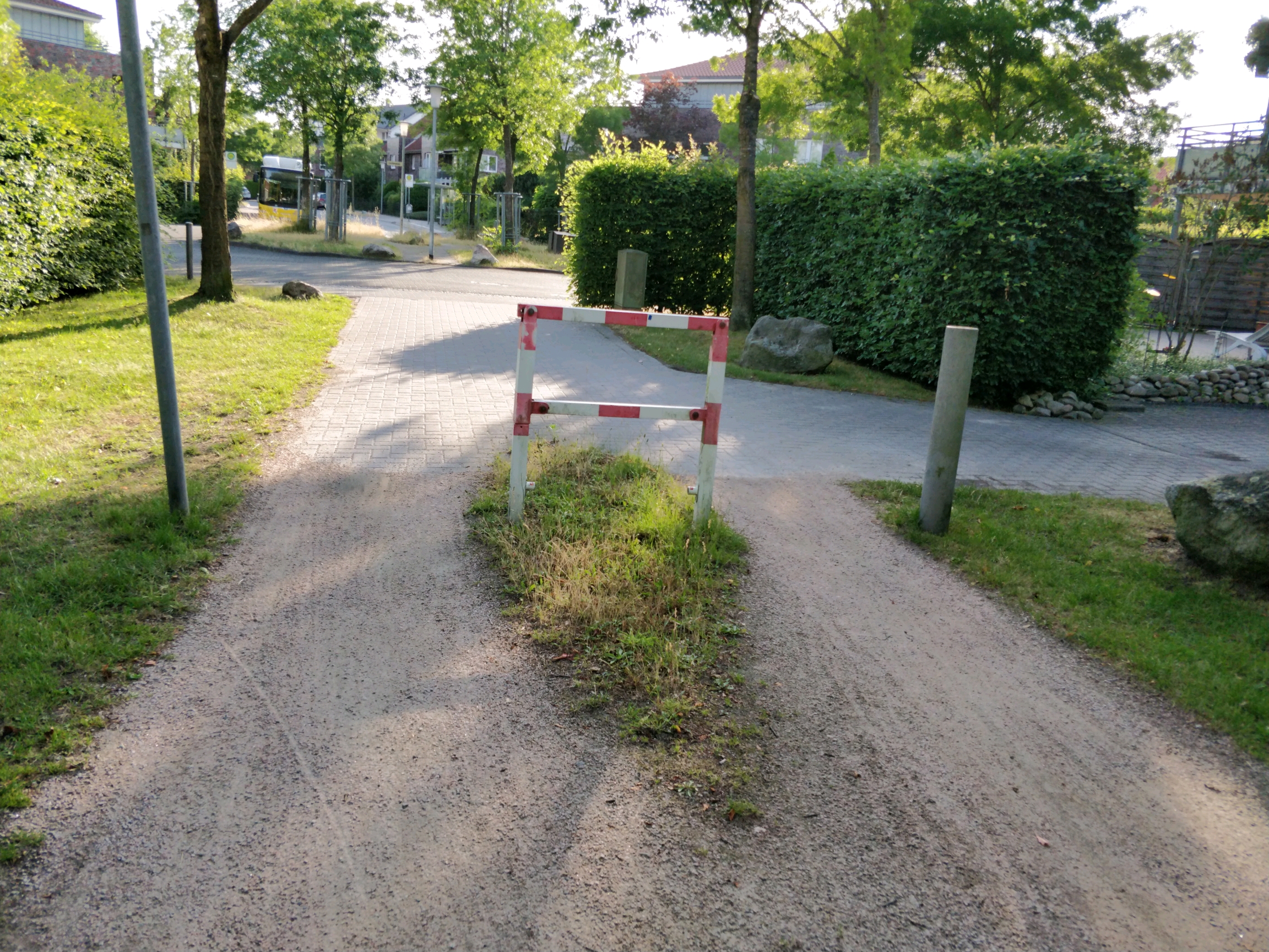
I found this kind of cycle barrier in Oldenburg right here:
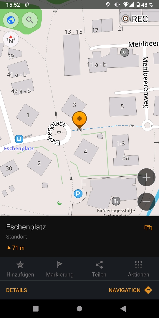
There are 2-3 similar barriers in the same region.
Problem: there is no design specified in openstreetmap fitting for those. How can this be solved?
(I mean the list below "Types / designs of cycle barriers" here: Cycle barrier in OSM Wiki )
320
321
322
324
325