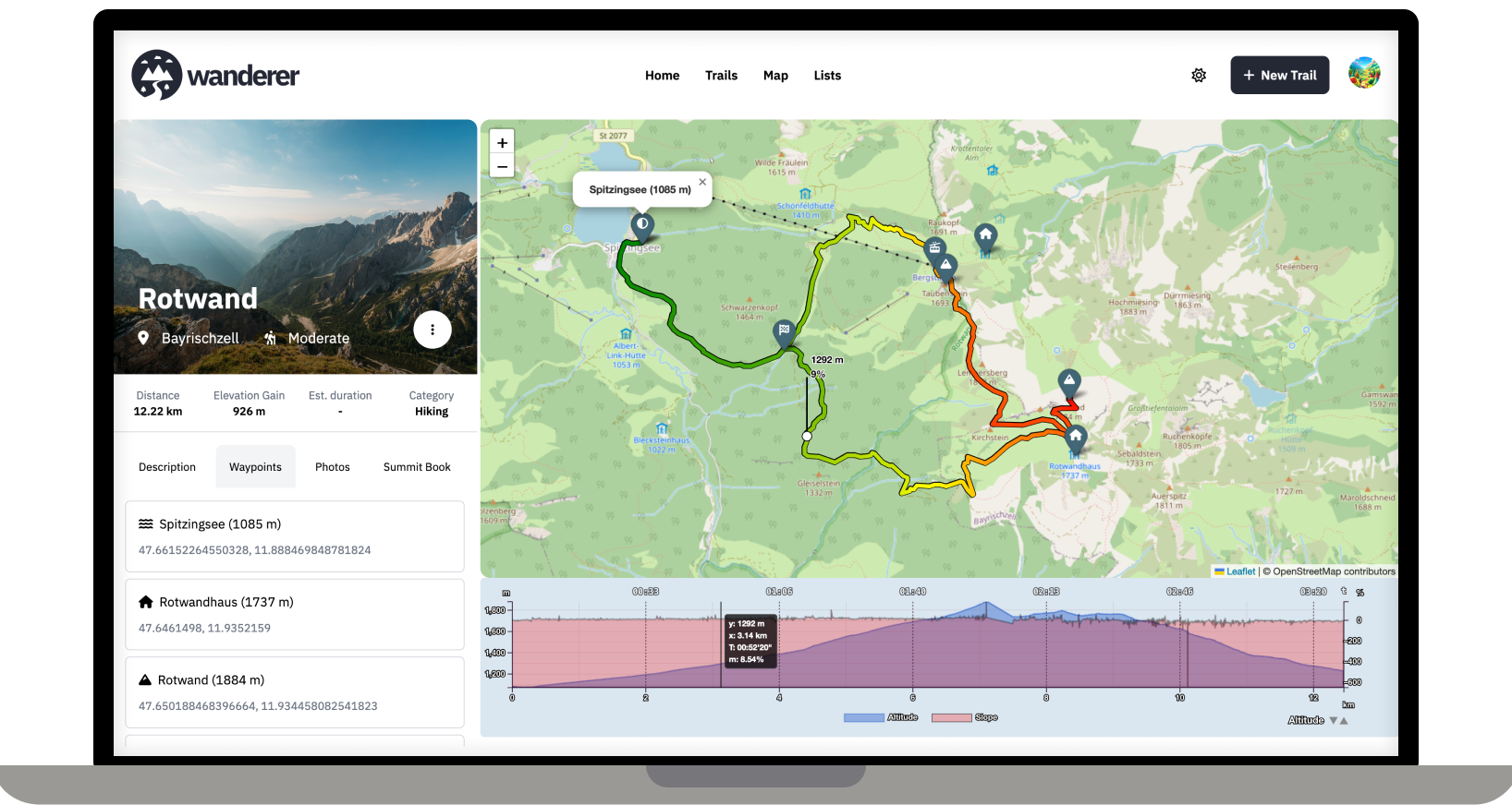
Over the last two months, I developed wanderer. It is a self-hosted alternative to sites like alltrails.com or in other words a self-hosted trail database. It started out more as a small hobby project to teach myself some new technologies but in the end, I decided to develop it into a fully-fledged application.
Core Features:
- Manage your trails
- Extensive map integration and visualization
- Share trails with other people and explore theirs
- Advanced filter and search functionality
- Create custom lists to organize your trails further
- Chique design with a dark and light theme
- Fully mobile compatible
wanderer is completely open-source. You can find the GitHub repo here: https://github.com/Flomp/wanderer
wanderer is still under active development so if you encounter any bugs/errors or have suggestions please let me know here or open an issue on GitHub.
These may be answered elsewhere, but like some other interested people in this post, I fully intend on trying to load a copy of this when I get home from vacation.
What methods/devices do you use to upload/sync the data? Other than a regular smart phone, were you able to use other GPS enabled devices like garmin or apple smart watches?
And system requirements?
You can use whatever device you prefer. In the end, you simply need a GPX file that you upload through the web UI or the API. I am planning to support other formats like KML soon, though.
System requirements should be quite low. On the first startup you will need ~1GB of RAM. After that, the whole stack sits at around 100MB on my machine.
Oh KML support!
Looking forward to that!.
;)
I'll use it for running though. Hmm. I'm using KML on my running sections. Is it possible to get some stats and graph for pinpointing and an average?
Currently wanderer supports visualising duration, distance, elevation gain and speed. Support for heart rate is planned. It can display a graph (the one you see in the screenshot) and also calculates an average.
This was very helpful, you are an amazing human.
That's great. Thank you very much for your work.
I use a banglejs 2 as a smart phone is way to bulky to carry while running. The bangle 2 is a JavaScript based watch with a GPS receiver.