this post was submitted on 27 May 2026
46 points (94.2% liked)

Map Enthusiasts

6153 readers
81 users here now

For the map enthused!

Rules:

founded 3 years ago
MODERATORS
 
top 6 comments
sorted by: hot top controversial new old
[–] infeeeee@lemmy.zip 2 points 1 hour ago

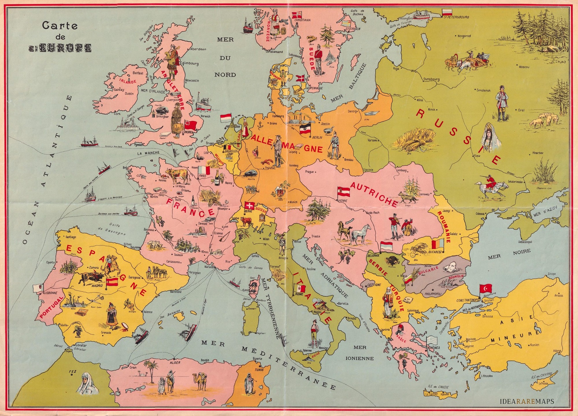
It's should be from 1878-1885, as it shows Eastern Rumelia as a somewhat separate state. It was an autonomous province of Bulgaria for that 8 years; https://en.wikipedia.org/wiki/Eastern_Rumelia

I couldn't find anything to narrow it even more.

But it has some errors, e.g. Austria wa called Austria-Hungary at that time

[–] morto@piefed.social 11 points 3 hours ago

Those older maps with overlay drawings were so cool

[–] Sergio@piefed.social 2 points 1 hour ago

I love how Corsica has a picture of Napoleon.

[–] whyNotSquirrel@sh.itjust.works 6 points 3 hours ago (1 children)

I never understood if it was Prussia or already Germany before WW1

[–] PenguinInLaw@sh.itjust.works 9 points 3 hours ago

Prussian Kingdom was technically one state in the German Empire. But since the Prussian king was the emperor, distinction between them was somewhat artificial.

[–] PenguinInLaw@sh.itjust.works 5 points 3 hours ago

Pre-Balkan wars even.