
251
OpenStreetMap community
5129 readers
45 users here now
Everything #OpenStreetMap related is welcome: software releases, showing of your work, questions about how to tag something, as long as it has to do with OpenStreetMap or OpenStreetMap-related software.
OpenStreetMap is a map of the world, created by people like you and free to use under an open license.
Join OpenStreetMap and start mapping: https://www.openstreetmap.org/.
There are many communication channels about OSM, many organized around a certain country or region. Discover them on https://openstreetmap.community/
https://mapcomplete.org/ is an easy-to-use website to view, edit and add points (such as shops, restaurants and others)
https://learnosm.org/en/ has a lot of information for beginners too.
founded 5 years ago
MODERATORS
252
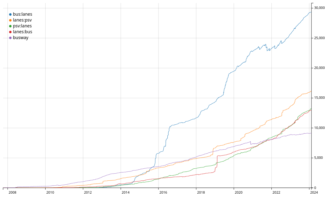
https://taghistory.raifer.tech/#/bus%3Alanes/&/lanes%3Apsv/&/psv%3Alanes/&/lanes%3Abus/&***/busway/
- https://wiki.openstreetmap.org/wiki/Key:bus:lanes
- https://wiki.openstreetmap.org/wiki/Key:lanes:psv
- https://wiki.openstreetmap.org/wiki/Key:psv:lanes
- https://wiki.openstreetmap.org/wiki/Key:busway
I use psv:lanes, but there are no real bus lanes here, it's called buslane, but law says taxis can also use it.
253
254
255
256
257
67
2024: announcing the year of the OpenStreetMap vector maps | OpenStreetMap Blog
(blog.openstreetmap.org)
258
19
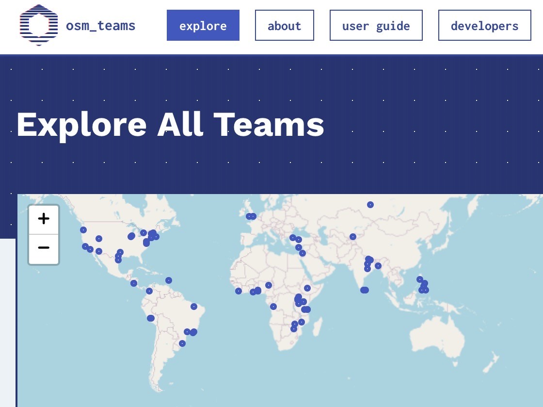
OSM Teams is a tool for creating teams and roles in the #OpenStreetMap ecosystem for management of groups and communities to organize around existing tools like Tasking Manager, OSMCha, or iD, and improves collaboration.
- Found or find a team: https://mapping.team/teams
- Video demo: https://www.youtube.com/watch?v=GSa4IWxZz4g
259
260
261
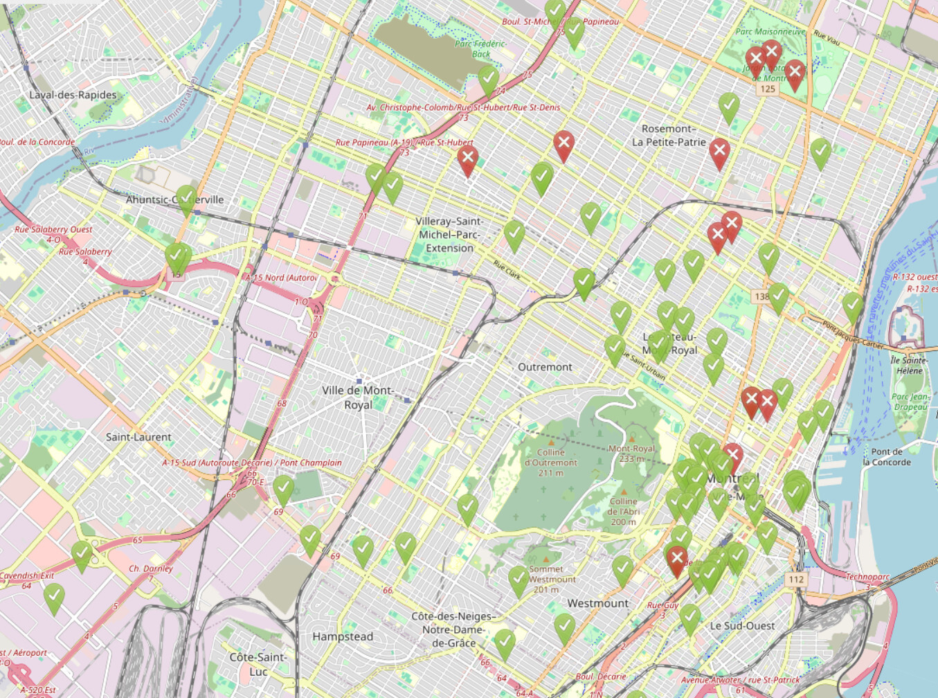
Unfortunately the OSM website has a limit to how many it can show you at once and it shows the most recently updated ones, so you can't see how many unclosed notes still exist.
One of them is over five years old and requires on-site verification, so I know what I'm doing this weekend!
262
263
264
51
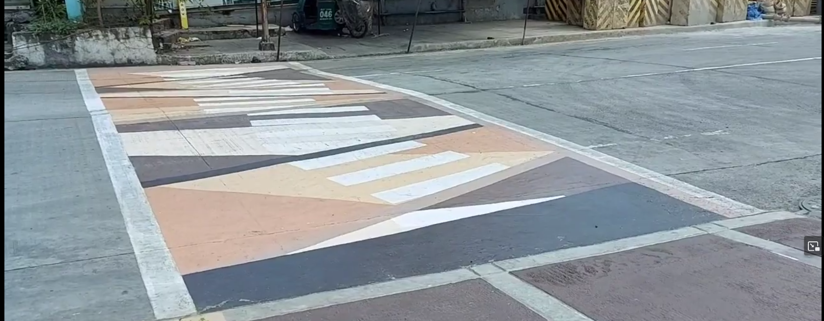
A nearby city call these crossings as "Gora¹ Lanes", an attempt to make walking fun, attractive, and accessible to more people.
(cdn.masto.host)
A nearby city call these crossings as "Gora¹ Lanes", an attempt to make walking fun, attractive, and accessible to more people.
From the screenshot² below, it's something like an arty zebra (or "continental") crossing, and I saw minimal use of crossing:markings=artwork in #OpenStreetMap, and taggable with crossing:markings=yes.
I wonder how you folks might tag it.
¹ - Gora is an acronym from "Green Open Reclaimed Access"
² - Source: screenshot, https://yewtu.be/lKMFjLcTVkQ?t=59
265
23
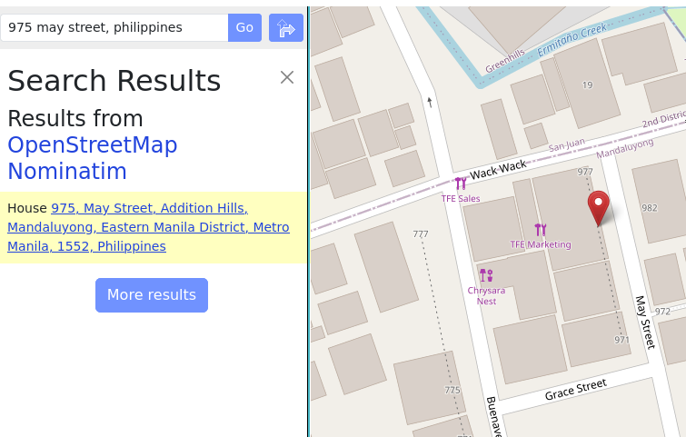
When mapping street addresses in #OpenStreetMap, the minimum tag you probably need is addr:housenumber and addr:street, or maybe addr:place.
(cdn.masto.host)
When mapping street addresses in #OpenStreetMap, the minimum tag you probably need is addr:housenumber and addr:street, or maybe addr:place.
In this example, house numbers 971 and 977 are the only two points actually mapped, and connected by a way tagged with addr:interpolation=odd.
The geocoder still returned the estimated position for the unmapped housenumber, 975.
Read about interpolation here: https://osm.org/wiki/Addresses#Interpolation
It's a quick method for adding street addresses in @openstreetmap
266
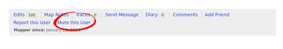
Have you been receiving unsolicited messages in your #OpenStreetMap inbox?
Well, it seems like this feature has been quietly introduced recently: "mute this user" link is now available for every @openstreetmap user page.
267
268
28
When editing #OpenStreetMap on the go, @everydoor is my hands-down favorite, but I'd hesitate recommending it for more new mappers.
(cdn.masto.host)
When editing #OpenStreetMap on the go, @everydoor is my hands-down favorite, but I'd hesitate recommending it for more new mappers.
I've been playing with #OsmGo just now, and really like how easy it is, maybe even for new contributors.
Plus, it's a progressive web app that runs in a browser, or installable in your device: https://osmgo.com , so this also seems to be a great candidate tool to introduce as a friendly editor for @openstreetmap mapping parties for new users.
269
-12
Organic maps which claims to be ad-free was marked by F-Droid as “Containing ads”
(discuss.tchncs.de)
270
272
273
274
275